Yanjin County, Henan
Yanjin County (Chinese: 延津; pinyin: Yánjīn) is a county under the administration of the prefecture-level city of Xinxiang, in the north of Henan province, China.
Yanjin
延津县 Yentsing | |
|---|---|
| Yanjin County | |
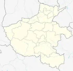 Yanjin Location of the seat in Henan | |
| Coordinates: 35°09′57″N 114°12′21″E | |
| Country | People's Republic of China |
| Province | Henan |
| Prefecture-level city | Xinxiang |
| Area | |
| • Total | 886 km2 (342 sq mi) |
| Population (2019)[2] | |
| • Total | 456,900 |
| • Density | 520/km2 (1,300/sq mi) |
| Time zone | UTC+8 (China Standard) |
| Postal code | 453200 |
| Area code | 0373 |
Geography environment[3]
- Location Realm
- Located at 35°10′ N latitude and 114°36′ E longitude, it is in the north of Henan Province, on the north bank of the Yellow River, and is situated in the core hinterland of the Central Plains City Cluster. It is 37 km from Xinxiang to the west, 93 km from Zhengzhou to the south, 50 km from Kaifeng to the southeast, and 130 km from Anyang to the north. The area is 45.5 km wide from north to south and 42.5 km long from east to west, with a total area of 886 square kilometers.
- Terrain and landforms
- Yanjin County is located in the Yellow River basin, the entire territory is a plain, no mountains, the north has a large number of rolling sandy land
- Climate
- Yanjin County is a warm temperate continental monsoon climate, with four distinct seasons, cold in winter and hot in summer, cool in autumn, and early in spring, the annual average temperature of 14 ℃; July is the hottest, an average of 27.3 ℃; January is the coldest, an average of 0.2 ℃; precipitation: the annual average rainfall of 656.3 mm, June to September precipitation is the most, accounting for 70% of the annual precipitation, and more heavy rainfall. The frost-free period is 220 days, and the annual sunshine time is about 2400 hours.
| Climate data for Yanjin (1981−2010) | |||||||||||||
|---|---|---|---|---|---|---|---|---|---|---|---|---|---|
| Month | Jan | Feb | Mar | Apr | May | Jun | Jul | Aug | Sep | Oct | Nov | Dec | Year |
| Record high °C (°F) | 18.6 (65.5) |
25.4 (77.7) |
27.4 (81.3) |
34.5 (94.1) |
37.2 (99.0) |
40.6 (105.1) |
39.1 (102.4) |
36.9 (98.4) |
37.1 (98.8) |
33.8 (92.8) |
27.5 (81.5) |
22.5 (72.5) |
40.6 (105.1) |
| Average high °C (°F) | 5.1 (41.2) |
8.7 (47.7) |
14.0 (57.2) |
21.0 (69.8) |
26.4 (79.5) |
31.7 (89.1) |
31.3 (88.3) |
30.0 (86.0) |
26.5 (79.7) |
21.4 (70.5) |
13.6 (56.5) |
7.0 (44.6) |
19.7 (67.5) |
| Daily mean °C (°F) | −0.4 (31.3) |
3.0 (37.4) |
8.2 (46.8) |
15.0 (59.0) |
20.4 (68.7) |
25.6 (78.1) |
26.8 (80.2) |
25.4 (77.7) |
20.9 (69.6) |
15.3 (59.5) |
7.7 (45.9) |
1.6 (34.9) |
14.1 (57.4) |
| Average low °C (°F) | −4.7 (23.5) |
−1.7 (28.9) |
3.0 (37.4) |
9.2 (48.6) |
14.6 (58.3) |
20.0 (68.0) |
22.8 (73.0) |
21.5 (70.7) |
16.2 (61.2) |
10.1 (50.2) |
2.8 (37.0) |
−2.9 (26.8) |
9.2 (48.6) |
| Record low °C (°F) | −16.0 (3.2) |
−15.1 (4.8) |
−6.4 (20.5) |
−1.2 (29.8) |
4.5 (40.1) |
9.8 (49.6) |
16.5 (61.7) |
11.4 (52.5) |
5.0 (41.0) |
−1.6 (29.1) |
−13.7 (7.3) |
−14.0 (6.8) |
−16.0 (3.2) |
| Average precipitation mm (inches) | 5.3 (0.21) |
8.1 (0.32) |
20.3 (0.80) |
26.2 (1.03) |
56.2 (2.21) |
68.0 (2.68) |
158.5 (6.24) |
122.8 (4.83) |
63.7 (2.51) |
32.1 (1.26) |
17.2 (0.68) |
5.8 (0.23) |
584.2 (23) |
| Average relative humidity (%) | 60 | 61 | 63 | 67 | 70 | 65 | 80 | 83 | 78 | 70 | 67 | 63 | 69 |
| Source: China Meteorological Data Service Center[4] | |||||||||||||
Administrative divisions
As of October 2021, Yanjin County has 13 county-level administrative districts, including 3 streets, 4 towns and 6 townships.
- Districts
- Wenyan District(文岩街道)
- Tanlong District(潭龙街道)
- Tapu District(塔铺街道)
- Towns
- Shipogu Town(石婆固镇)
- Dongtun Town(东屯镇)
- Fengzhuang Town(丰庄镇)
- Wanglou Town(王楼镇)
- Townships
- Senggu Township(僧固乡)
- Weiqiu Township(魏邱乡)
- Sizhai Township(司寨乡)
- Mazhuang Township(马庄乡)
- Zuocheng Township(胙城乡)
- Yulin Township(榆林乡)
Natural Resources
- Land Resources
- Yanjin County is located in the old Yellow River area, there are 200,000 mu of undeveloped state-owned sand dunes and sand wasteland in the territory, and there is sufficient land for construction.[5]
- Sand and soil resources
- Yanjin County is rich in sandy soil resources, with 200 million cubic meters of reserves.
History and Culture
- Dapingdiao[6]
- Dapingdiao is one of the Han Chinese opera genres spread in the five provinces of Central China, and its voice belongs to the Bang Zi cadence system.
- On May 20, 2006, Dapingdiao was approved by the State Council to be included in the first batch of the national intangible cultural heritage list.
- Erjiaxian[7]
- Erjiaxian is also known as the "Wudayin". It is one of the Chinese Han opera genres. It is a local opera mainly popular in western Shandong, eastern and northern Henan, northern Jiangsu, and northern Anhui provinces.
- In 2008, Erjiaxian was selected as the second batch of the national intangible cultural heritage list.
References
- 最新人口信息 www.hongheiku.com (in Chinese). hongheiku. Retrieved 2021-01-12.
- 最新人口信息 www.hongheiku.com (in Chinese). hongheiku. Retrieved 2021-01-12.
- "延津地理区位及风貌" [Yanjin Geographical Location and Landscape]. 盐津县人民政府 (in Chinese). 2015-08-07.
- 中国地面气候标准值月值(1981-2010) (in Simplified Chinese). China Meteorological Data Service Center. Retrieved 17 November 2022.
- "土地资源优势" [Land Resource Advantage]. 延津县人民政府 (in Chinese). 2015-08-07.
- "非物质文化遗产——延津县大平调" [Intangible Cultural Heritage - Yanjin County Dapingdiao]. 延津县人民政府 (in Chinese). 2015-08-07.
- "非物质文化遗产——延津二夹弦" [Intangible Cultural Heritage - Yanjin Erjiaxian]. 延津县人民政府 (in Chinese). 2015-08-07.
This article is issued from Wikipedia. The text is licensed under Creative Commons - Attribution - Sharealike. Additional terms may apply for the media files.