Whites City, New Mexico
Whites City is a census-designated place and unincorporated community in Eddy County, New Mexico, United States. Its population was 7 as of the 2010 census. By 2020 the population increased to 85. Whites City has a post office with ZIP code 88268.[4][5]
Whites City, New Mexico | |
|---|---|
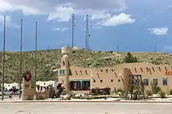 White's City, en route to Carlsbad Caverns National Park | |
 Flag | |
 Whites City | |
| Coordinates: 32°10′36″N 104°22′36″W | |
| Country | United States |
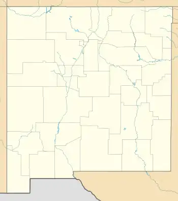
| State | New Mexico |
| County | Eddy |
| Area | |
| • Total | 0.43 sq mi (1.12 km2) |
| • Land | 0.43 sq mi (1.12 km2) |
| • Water | 0.00 sq mi (0.00 km2) |
| Elevation | 3,662 ft (1,116 m) |
| Population | |
| • Total | 14 |
| • Density | 32.26/sq mi (12.46/km2) |
| Time zone | UTC-7 (Mountain (MST)) |
| • Summer (DST) | UTC-6 (MDT) |
| ZIP code | 88268 |
| Area code | 575 |
| GNIS feature ID | 2584237[2] |
Whites City began in the 1920s as a commercial resort owned by Charlie White.[6] The community is primarily a resort town for visitors to nearby Carlsbad Caverns National Park.[7] U.S. Route 62, 180, and New Mexico State Road 7 all pass through the community.
It is within the Carlsbad Municipal School District,[8] which operates Carlsbad High School.
References
- "ArcGIS REST Services Directory". United States Census Bureau. Retrieved October 12, 2022.
- U.S. Geological Survey Geographic Names Information System: Whites City, New Mexico
- "Census Population API". United States Census Bureau. Retrieved Oct 12, 2022.
- United States Postal Service (2012). "USPS - Look Up a ZIP Code". Retrieved 2012-02-15.
- "Postmaster Finder - Post Offices by ZIP Code". United States Postal Service. Retrieved March 4, 2014.
- Rivero, Nicolas (25 August 2017). "The Smallest Town in Each of the 50 States". Mental Floss. Retrieved 25 June 2018.
- "White's City History". Historic White's City New Mexico. Retrieved March 4, 2014.
- "2020 CENSUS - SCHOOL DISTRICT REFERENCE MAP: Eddy County, NM" (PDF). U.S. Census Bureau. Retrieved 2022-06-28.
- "Census of Population and Housing". Census.gov. Retrieved June 4, 2016.
Municipalities and communities of Eddy County, New Mexico, United States | ||
|---|---|---|
| Cities | 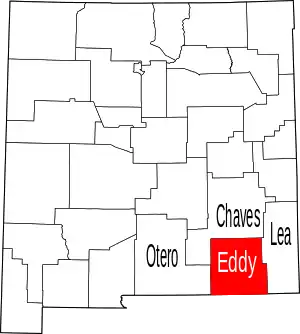 Map of New Mexico highlighting Eddy County | |
| Villages | ||
| CDPs | ||
| Unincorporated communities | ||
This article is issued from Wikipedia. The text is licensed under Creative Commons - Attribution - Sharealike. Additional terms may apply for the media files.