Týniště (Plzeň-South District)
Týniště is a municipality and village in Plzeň-South District in the Plzeň Region of the Czech Republic. It has about 50 inhabitants.
Týniště | |
|---|---|
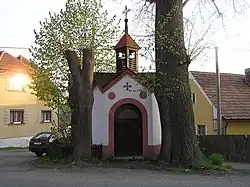 Chapel in Týniště | |
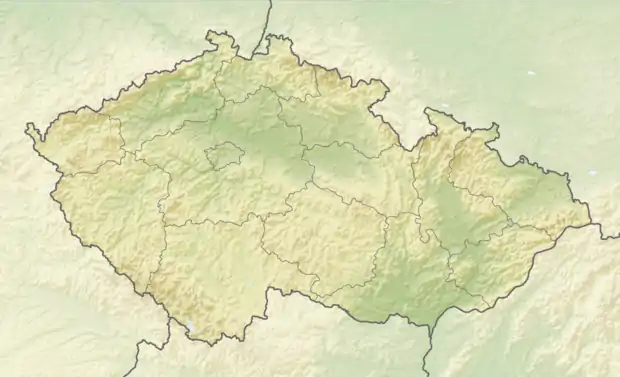 Týniště Location in the Czech Republic | |
| Coordinates: 49°31′16″N 13°25′3″E | |
| Country | |
| Region | Plzeň |
| District | Plzeň-South |
| First mentioned | 1379 |
| Area | |
| • Total | 8.09 km2 (3.12 sq mi) |
| Elevation | 530 m (1,740 ft) |
| Population (2022-01-01)[1] | |
| • Total | 50 |
| • Density | 6.2/km2 (16/sq mi) |
| Time zone | UTC+1 (CET) |
| • Summer (DST) | UTC+2 (CEST) |
| Postal code | 334 01 |
| Website | www |
Geography
Týniště is located about 23 km (14 mi) south of Plzeň. It lies in the Švihov Highlands. The highest point is the hill Stará pec at 589 m (1,932 ft) above sea level. The Zlatý Brook springs here and flows across the municipality.
History
The first written mention of Týniště is from 1379, under its former name Pustá. The name Týniště was first documented in 1542.[2]
From 1961 to 1990, Týniště was administrative part of Horšice. Since 1 September 1990, the municipality has been separate again.[3]
References
- "Population of Municipalities – 1 January 2022". Czech Statistical Office. 2022-04-29.
- "Historie obce Týniště" (in Czech). Obec Týniště. Retrieved 2022-11-19.
- "Historický lexikon obcí České republiky 1869–2011" (in Czech). Czech Statistical Office. 2015-12-21. p. 588.
This article is issued from Wikipedia. The text is licensed under Creative Commons - Attribution - Sharealike. Additional terms may apply for the media files.