Panjab, Afghanistan
Panjab (Pashto/Persian: پنج اب) (meaning 'five rivers') is the capital of Panjab District, a mountainous district in the southwestern part of the Bamyan Province, Afghanistan. The town is situated at 34°23'N 67°1'E and has an altitude of 2,758 m altitude,[1] the population was 9,900 in the year 2004. There is an airport with gravel surface.
Panjab
پنج اب | |
|---|---|
City | |
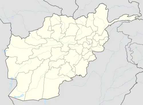 Panjab Location in Afghanistan | |
| Coordinates: 34°23′N 67°1′E | |
| Country | |
| Province | Bamyan |
| District | Panjab |
| Elevation | 2,758 m (9,049 ft) |
| Population (2004) | |
| • Total | 9,900 |
| Time zone | UTC+4:30 (AST) |
Climate
Owing to its high altitude, Panjab features a humid continental climate (Dsb) under the Köppen climate classification. It has warm, dry summers and cold, snowy winters. The annual precipitation averages 534.1 millimetres (21.0 in).
The average temperature in Panjab is 3.6 °C (38.5 °F). July is the warmest month of the year with an average temperature of 17.8 °C (64.0 °F). The coldest month January has an average temperature of −12.9 °C (8.8 °F).
| Climate data for Panjab, Bamyan Province (1990-2022) | |||||||||||||
|---|---|---|---|---|---|---|---|---|---|---|---|---|---|
| Month | Jan | Feb | Mar | Apr | May | Jun | Jul | Aug | Sep | Oct | Nov | Dec | Year |
| Record high °C (°F) | 5 (41) |
5 (41) |
16 (61) |
22 (72) |
25 (77) |
30 (86) |
33 (91) |
29 (84) |
28 (82) |
22 (72) |
13 (55) |
8 (46) |
33 (91) |
| Average high °C (°F) | −18.0 (−0.4) |
−15.9 (3.4) |
−6.4 (20.5) |
8.7 (47.7) |
16.0 (60.8) |
20.9 (69.6) |
23.7 (74.7) |
22.8 (73.0) |
19.9 (67.8) |
12.7 (54.9) |
3.9 (39.0) |
−2.2 (28.0) |
7.2 (44.9) |
| Daily mean °C (°F) | −24.1 (−11.4) |
−22.2 (−8.0) |
−13.3 (8.1) |
0.0 (32.0) |
8.5 (47.3) |
15.6 (60.1) |
17.0 (62.6) |
16.2 (61.2) |
11.9 (53.4) |
1.2 (34.2) |
−11.8 (10.8) |
−20.6 (−5.1) |
−1.8 (28.8) |
| Average low °C (°F) | −30.2 (−22.4) |
−28.5 (−19.3) |
−20.2 (−4.4) |
−8.7 (16.3) |
5.7 (42.3) |
9.6 (49.3) |
11.8 (53.2) |
10.4 (50.7) |
6.3 (43.3) |
−0.6 (30.9) |
−7.4 (18.7) |
−15.3 (4.5) |
−5.6 (21.9) |
| Record low °C (°F) | −34 (−29) |
−37 (−35) |
−29 (−20) |
−17 (1) |
−5 (23) |
0 (32) |
5 (41) |
0 (32) |
−6 (21) |
−12 (10) |
−20 (−4) |
−31 (−24) |
−37 (−35) |
| Average precipitation mm (inches) | 63.7 (2.51) |
107.5 (4.23) |
80.5 (3.17) |
90.2 (3.55) |
75.2 (2.96) |
12.7 (0.50) |
6.4 (0.25) |
4.7 (0.19) |
3.1 (0.12) |
15.3 (0.60) |
48.5 (1.91) |
26.3 (1.04) |
534.1 (21.03) |
| Average snowfall cm (inches) | 62.6 (24.6) |
103.6 (40.8) |
75.4 (29.7) |
48.9 (19.3) |
4.2 (1.7) |
0.0 (0.0) |
0.0 (0.0) |
0.0 (0.0) |
0.0 (0.0) |
7.7 (3.0) |
45.7 (18.0) |
25.7 (10.1) |
373.8 (147.2) |
| Source: World Weather Online[2] | |||||||||||||
See also
References
- Location of Panjab - Falling Rain Genomics Archived November 17, 2007, at the Wayback Machine
- "Panjab, World Weather Online". Retrieved 26 September 2022.
External links
- District profile at Bamyan.info
- AIMS District Map
- Punjab Portal
- Statoids Punjab - (Punjab: Panjab (German); Pendjab, Penjab (French).)